![]() Federal University of Paraná
Federal University of Paraná ![]() Curitiba, Brazil
Curitiba, Brazil ![]() Individual
Individual ![]() Not built
Not built ![]() 2.64 km²
2.64 km²
Urban District Requalification | Academic Project
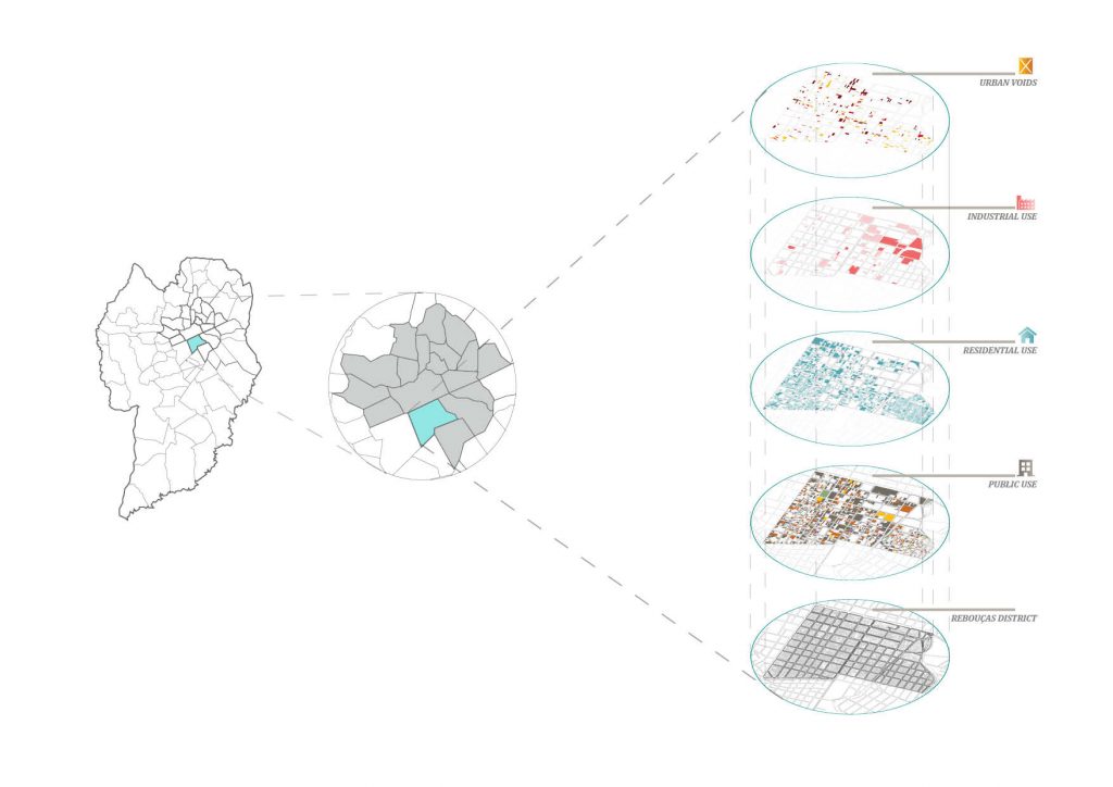
The presented images are fragments of a graduation project developed as a bachelor student in Architecture and Urbanism course at UFPR. It covers different scales: from the general scales (city, neigborhoods) at the planning level, to the project cut (sector), at multidisciplinary level; through urban design tools defined by the general analysis of the neigborhood. For the sector detailed, four actions were proposed: expansion of the cycling network; incorporation of the fair into the rest of the area; incentive to commerce; linear park and animation axis.
The Problem
The degradation of the neighborhood reduces its use and appropriation by the population, both local and the rest of the city. The current configuration of Rebouças ended up creating a degraded and criminalized landscape, which still has a profile of abandonment, despite being in a central region of the city. This same abandonment creates a rupture that segregates Rebouças and its neighbors, fulfilling, for the most part, only a function of passage within the dynamics of the municipality.
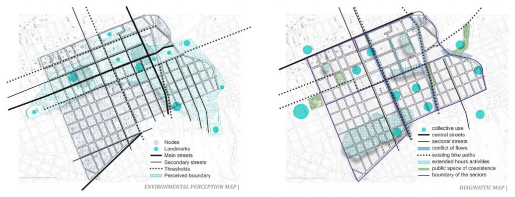
Methodology and Diagnosis
Through research conducted with local and city residents, it was possible to establish a map of environmental perception of the space, identifying the main challenges and potentialities of each part of the neighborhood. This served as the basis for the creation of a diagnostic map.
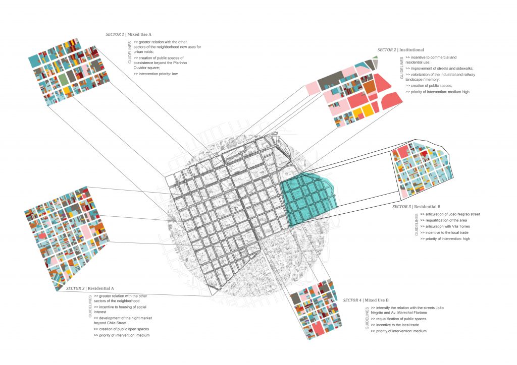
Guidelines for the neighborhood
Using the diagnostic map to define the strategies to be adopted in the intervention, the area was divided into five intervention sectors according to their use profiles, block typologies, heights and densities. Through sectorization, objectives and guidelines for each sector were established, taking into account their particularities and the general objectives and guidelines defined for the whole neighborhood.
System of public spaces of coexistence
Incorporate the banks of the river Belém into the landscape, generating appropriation by the population and create a system of connected public spaces with adequate infrastructure.
Bicycle path system
Incorporation of the network into the main streets, especially those with commercial vocation, encouraging appropriation of public spaces by the population.
Incorporation of the street market
Change the market’s street to allow its growth, generating integration between the public spaces of the sector, and create spaces of permanence throughout the market.
Incentive to the appropriation of streets
Reduce conflicts between modes of transportation, create visual perspective and permanence areas, stablishing a more harmonious relationship with pedestrians and cyclists and allowing greater interaction of users and business in the sector.
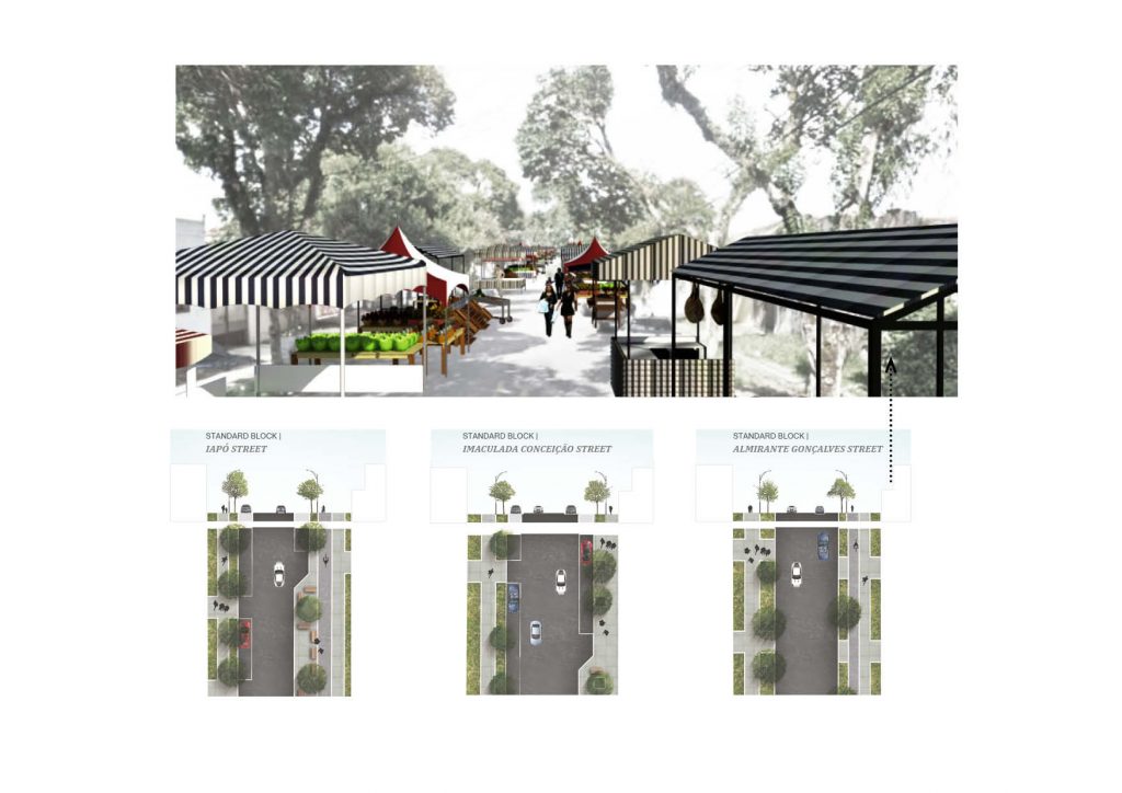
Street Market
To encourage the existing street market to grow – or even to attract other similar street events – it is suggested to move to Almirante Gonçalves Street, which connects to the east with the linear park of the river Belém, and to the west with the Animation Axis of Conselheiro Laurindo Street . Improvements to the sidewalks should also be carried out, as well as the expansion of the cycle path linking the two extremes and the creation of living spaces / urban gardens in the corners of a few blocks.
Commerce Streets
The streets Iapó and Imaculada Conceição cross the sector in the north-south direction and present the largest concentration of vicinal commerce. In order to reinforce this vocation, improvements in the existing sidewalks such as insertion of spaces of permanence along the roads should encourage the use of the public spaces by the inhabitants of the region. In addition, the expansion of the cycle network should also attract the population of the rest of the neighborhoods and neighborhoods nearby.
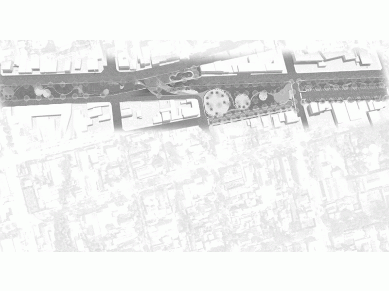
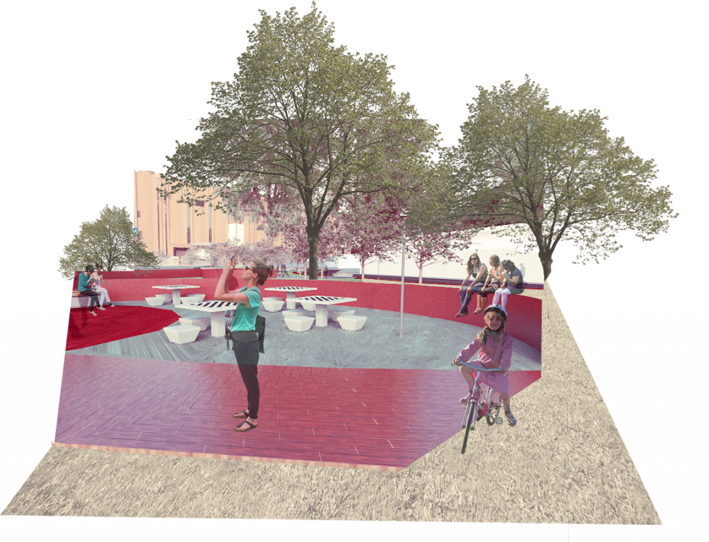
Animation Axis
The animation axis João Saldanha is currently underused and conforms as a barrier that divides two sectors of the district and that most of the time is occupied only by street dwellers who use the space to rest.
The intervention encourages greater integration between the sectors and greater interaction of residents with public spaces.The central square should function as a meeting point, with rubs of coexistence and space for small events, as well as one of the entrances to the street market, which arrives at its opposite end in the linear park of the river Belém, forming a system of interconnected public spaces.
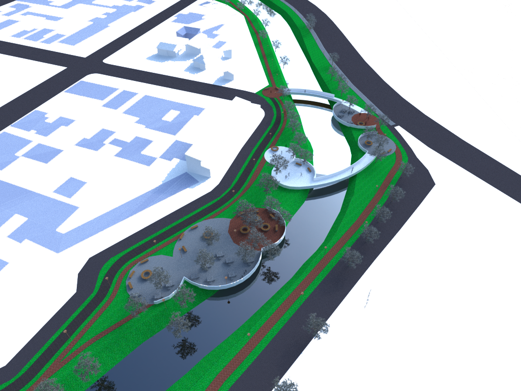
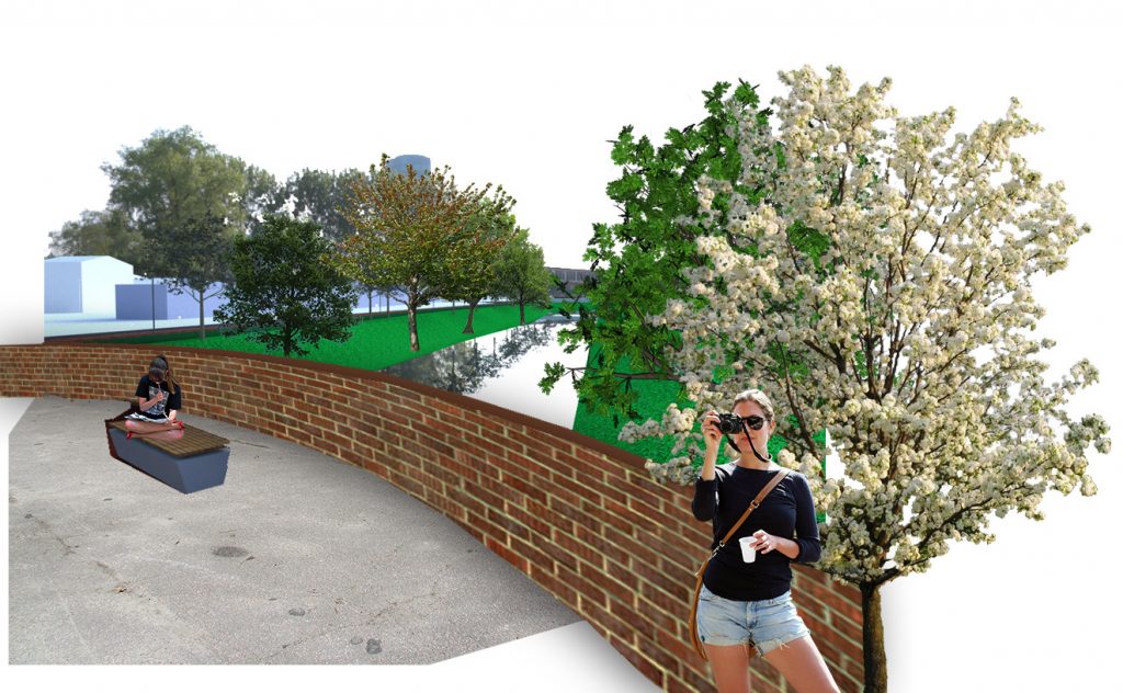
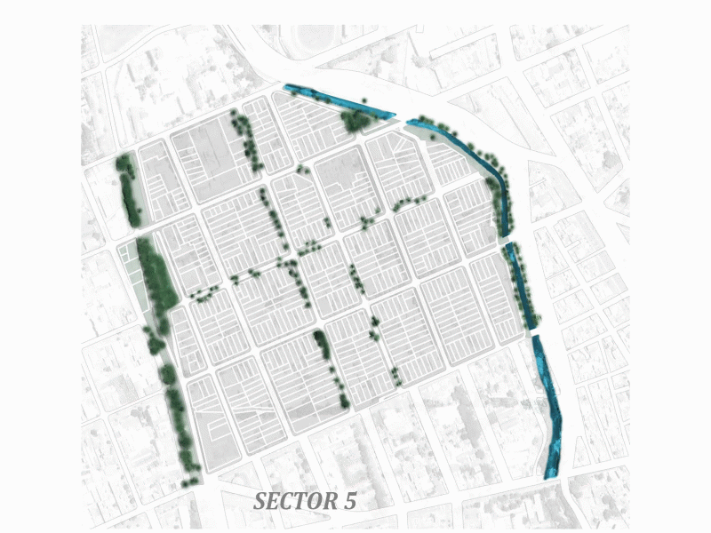
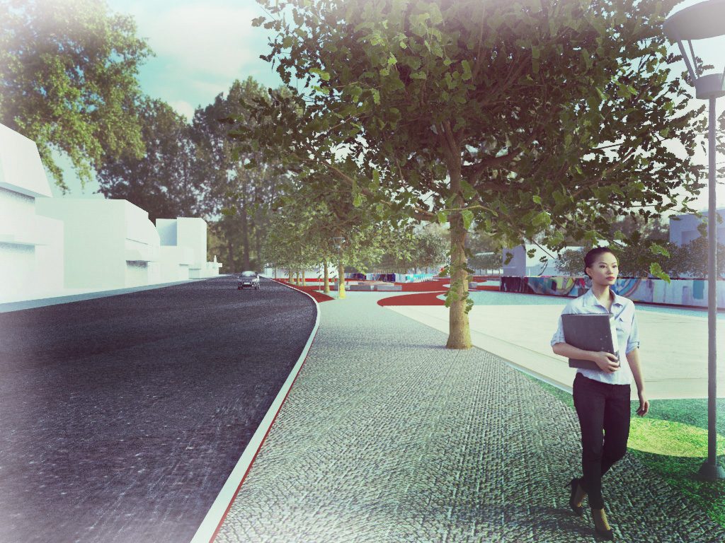
Belém River linear park
The linear park is part of a strategy to requalify the banks and decontaminate the river starting from Rebouças area to other parts of the city.